


-

"Very nice Posters. The quality is amazing and we received it very quickly !"
-

"A shop to visit absolutely. Huge selection of posters. We spent more than an hour there !"
-

"Perfect to find gift. Price are very good. An they can frame and pack it on site"


About the Artist
James Reynolds was a prominent British mapmaker in the mid-19th century, known for his innovative approach to cartography during a period of rapid scientific advancement. His maps often served as educational tools, reflecting a time when the visualization of meteorological and navigational knowledge was becoming increasingly important to both professionals and the public. The 1850s saw a surge in thematic mapping, as publishers sought to make complex concepts accessible through clear, engaging design.
Reynolds' work is especially valued today by collectors of vintage maps and those interested in the intersection of science and art in historical printmaking.
The Artwork
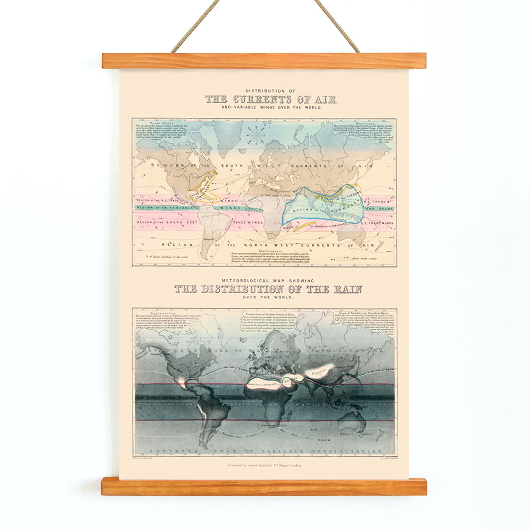
This 1854 map, Air and Variable Winds, was created at a time when global wind patterns were being systematically charted for the first time. Drawing on data from ship logs and coastal observations, the map was designed to educate viewers about the movement of air currents and the significance of prevailing winds for navigation and trade. It offered practical insights for sailors and merchants, while also appealing to the curiosity of an increasingly scientifically literate public.
The map reflects a growing understanding of the interconnectedness of weather systems and their impact on global travel and commerce, capturing a pivotal moment in the history of meteorology.
Style & Characteristics
The artwork features a finely detailed world map, with precise directional arrows and annotated wind patterns that sweep across the continents and oceans. The composition is orderly and balanced, typical of 1850s educational engravings. Soft washes of blue, pink, and yellow highlight different wind zones, set against a warm beige background that gives the print an inviting, antique quality. Delicate grey linework and careful labeling enhance legibility and add to the archival feel.
The overall mood is calm and contemplative, making it an ideal example of a hand-colored vintage science print that complements other science themed wall art in a thoughtful interior.
In Interior Design
This decorative map is well suited for a study, library, or home office, where its historical and scientific themes can inspire curiosity and conversation. Its subtle color palette pairs beautifully with natural materials and neutral textiles, while the intricate details reward closer inspection. In a gallery wall arrangement, it harmonizes with beige toned prints and understated frames, contributing to a refined and cohesive vintage print display.