


-

"Very nice Posters. The quality is amazing and we received it very quickly !"
-

"A shop to visit absolutely. Huge selection of posters. We spent more than an hour there !"
-

"Perfect to find gift. Price are very good. An they can frame and pack it on site"


About the Artist
Created by an anonymous artist, this 1870 city plan reflects the highly skilled world of nineteenth century cartography, when maps were essential tools for administrators, engineers, merchants, and travelers. Many such plans were produced through careful surveying and then reproduced for wider circulation, balancing clarity with dense information.
As a vintage map print, it belongs to a tradition where accuracy and legibility were forms of prestige. Today it reads as both historical document and decorative art, appealing to those interested in antique city plans and urban history.
The Artwork
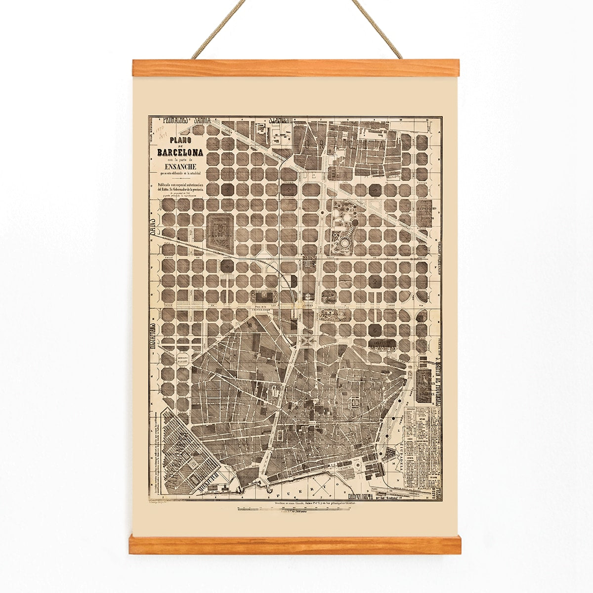
This Plano de Barcelona from 1870 captures a city in the midst of transformation, as modern planning and rapid expansion began to reshape its structure. The map serves as a record of how Barcelona was organized and navigated at a pivotal moment, documenting the street grid, blocks, and the logic of urban growth.
Such plans were practical objects, used to orient movement, coordinate services, and provide a shared understanding of the city. For those interested in place and memory, it naturally complements other Barcelona wall art and urban-themed collections.
Style & Characteristics
The map features a warm beige background with precise black linework, accented by subtle brown tones that add depth while maintaining clarity. The composition is orderly and rectilinear, inviting viewers to trace routes, intersections, and districts across the city.
Elegant typography and careful spacing contribute to a calm, archival atmosphere that feels both scholarly and nostalgic. This detailed city plan vintage print rewards close examination, making it a compelling choice for those drawn to historic cartography and maps.
In Interior Design
This Barcelona map brings a sense of history and sophistication to entryways, studies, or living rooms where guests can pause and explore its details. Its neutral palette pairs well with wood, leather, and stone, fitting seamlessly into minimalist, industrial, or classic interiors.
For a cohesive display, frame it simply in dark or natural wood and consider pairing it with other cartographic prints. To highlight its crisp geometry and historic character, explore suitable frames that keep the focus on the artwork itself.