


You may also like
-

Africa Map Poster
Rand McNally & Company · 1907 · Vintage print of Africa with finely labeled regions and softly tinted territories
Poster from CHF 9 · Framed from CHF 16
-

Political map of Europe Poster
Rand McNally & Company · 1931 · Political borders across Europe unfold in this detailed vintage poster
Poster from CHF 9 · Framed from CHF 16
-

Antique map of Brasil Poster
Institute of Leipzig · 1886 · Detailed Brasil vintage print with crisp borders and period German typography
Poster from CHF 9 · Framed from CHF 16
-

Septentrional and Meridional Poster
Josep Paluzie Lucena · 1899 · Detailed Americas vintage print with crisp labels and calm blue seas
Poster from CHF 9 · Framed from CHF 16


-

"Very nice Posters. The quality is amazing and we received it very quickly !"
-

"A shop to visit absolutely. Huge selection of posters. We spent more than an hour there !"
-

"Perfect to find gift. Price are very good. An they can frame and pack it on site"


About the Artist
Rand McNally & Company gives this map a direct link to the Chicago publishing world that shaped American geographic reference books. Founded in 1856, the firm built its reputation through maps made for practical use, from railroad travel to classroom study. By 1907, South America Map 2 represented a mature system for turning geographic knowledge into reference material. No individual artist is credited; Rand McNally and Company is the named creator, responsible for organizing information for readers. That context makes the art print distinct from a fine art print and unrelated to a named artistic movement. Today, the vintage poster carries that publishing history into home decor.
The Artwork
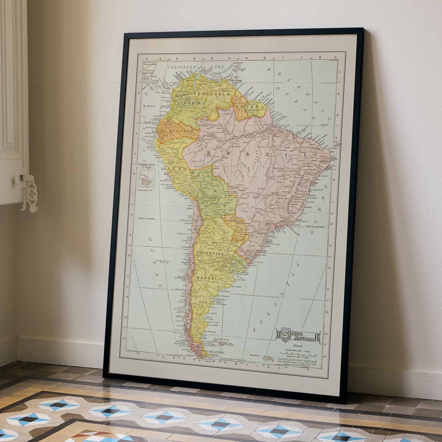
South America Map 2 was made to place a vast continent within reach of a reader in 1907. Printed atlases carried geographic knowledge into homes and schools, and this sheet offered a way to study national boundaries and travel routes without leaving the page. Its subject is a continental overview, inviting comparison between countries while recording the geography understood at the time. More than a century later, the vintage print preserves that encounter with place. A reader can begin with orientation and then follow the detail of a border crossing. As wall art, it retains the purpose of a historical map.
Style & Characteristics
The eye first follows the long vertical silhouette of the continent, broad across the north before narrowing toward Cape Horn. Brazil occupies the broad central-east area in dusty pink, while yellow washes across much of the west and the southern cone. Fine black lettering fills the countries, and thin boundaries separate neighboring territories. Rivers and route lines thread inland, with latitude and longitude lines crossing the pale grey sea. Small directional marks sit offshore, while an inset map appears at left. As wall art, the vintage poster rewards a distant glance before close reading.
In Interior Design
In a quiet study, the framed vertical poster hangs above a walnut desk. Morning light picks out the pale paper and gives the map a calm presence against the wood. From the chair, South America reads as one tall shape; closer inspection draws attention to the dense lettering along each coast. That shift from overview to detail suits a study, where wall art can invite a pause without becoming visual clutter. The vintage poster also turns historical geography into home decor with a clear educational thread. For interior decoration, its restrained cream and muted colors echo the room without demanding a matching scheme.